
Centennial Trail - Ft Meade to Bear Butte Lake

What you need to know:
Length - The map says 4.5, but it is closer to 5.2 or 5.4 if you use the tunnel to cross the highway.
Water - Bear Butte Creek should have water but check conditions first.
Camping - bear butte lake has a campground. no other camping.
Trail condition - The area near the FT Meade trailhead is a little confusing if you’re northbound. When crossing HWY 34 you can either walk across the hwy or if the hwy is busy, there is a tunnel underneath the hwy a 10th of a mile or so east of the crossing. once past the hwy, most of this section is prairie land and cow pastures making it easy to follow for the most part, but that also means there are very few trail signs. there are a few intersections in the pastures with no signs where you’ll want to check your track to make sure you’re going the right direction.
Notes - after the first 1/2 mile this section is completely out in the open with no shade. it can get very hot. also, if you have a problem with cows, you may have to make some detours to avoid them.

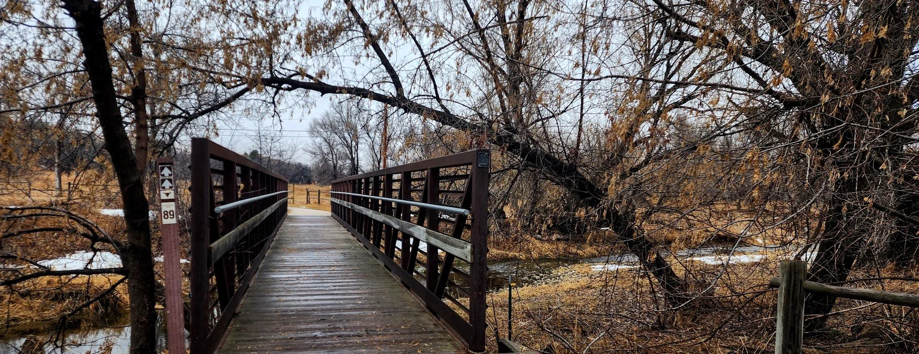
Start of the trail - hard to see the 89 sign from the parking lot since it was kind of covered by a bush.
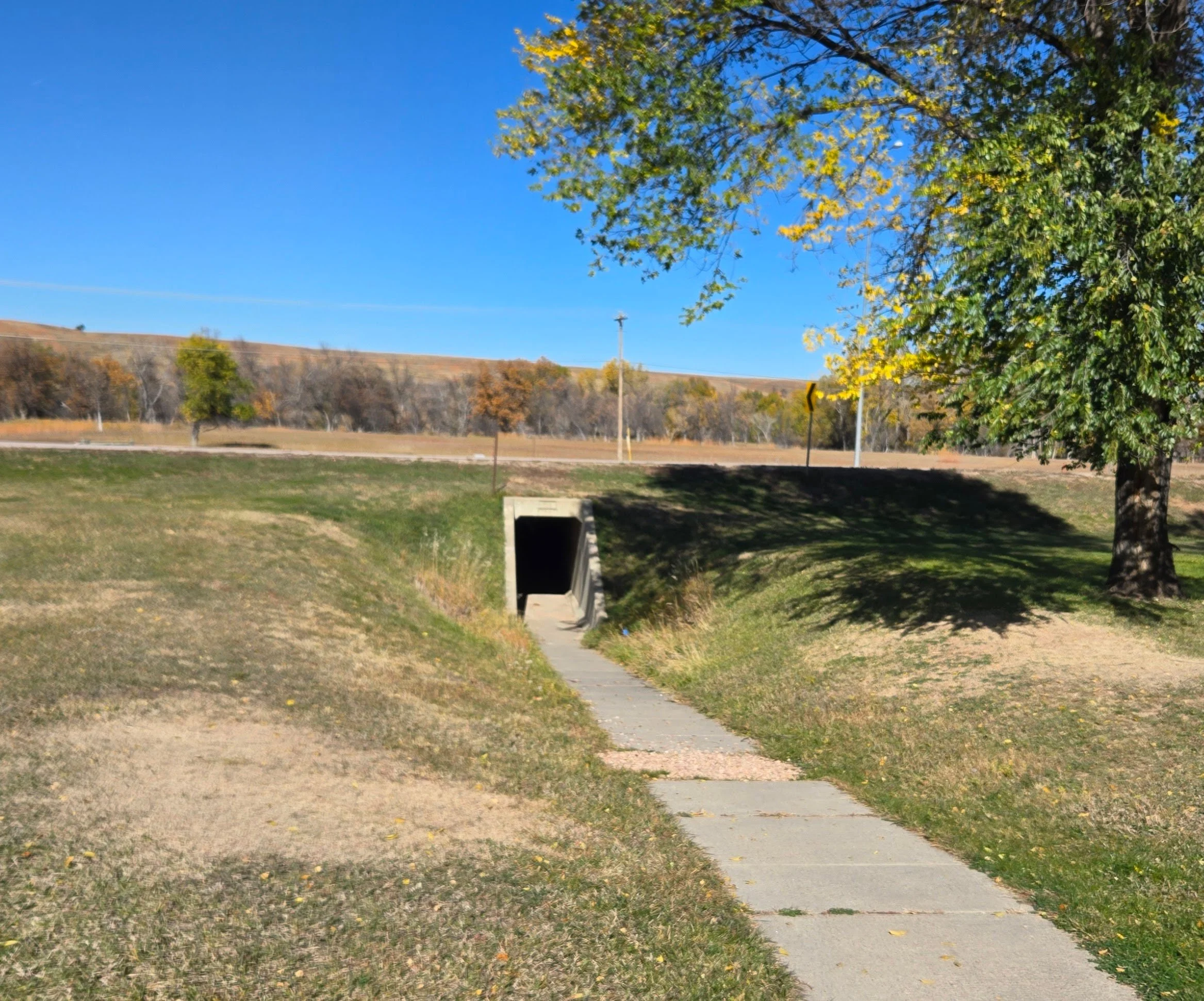
Tunnel under Highway 34.
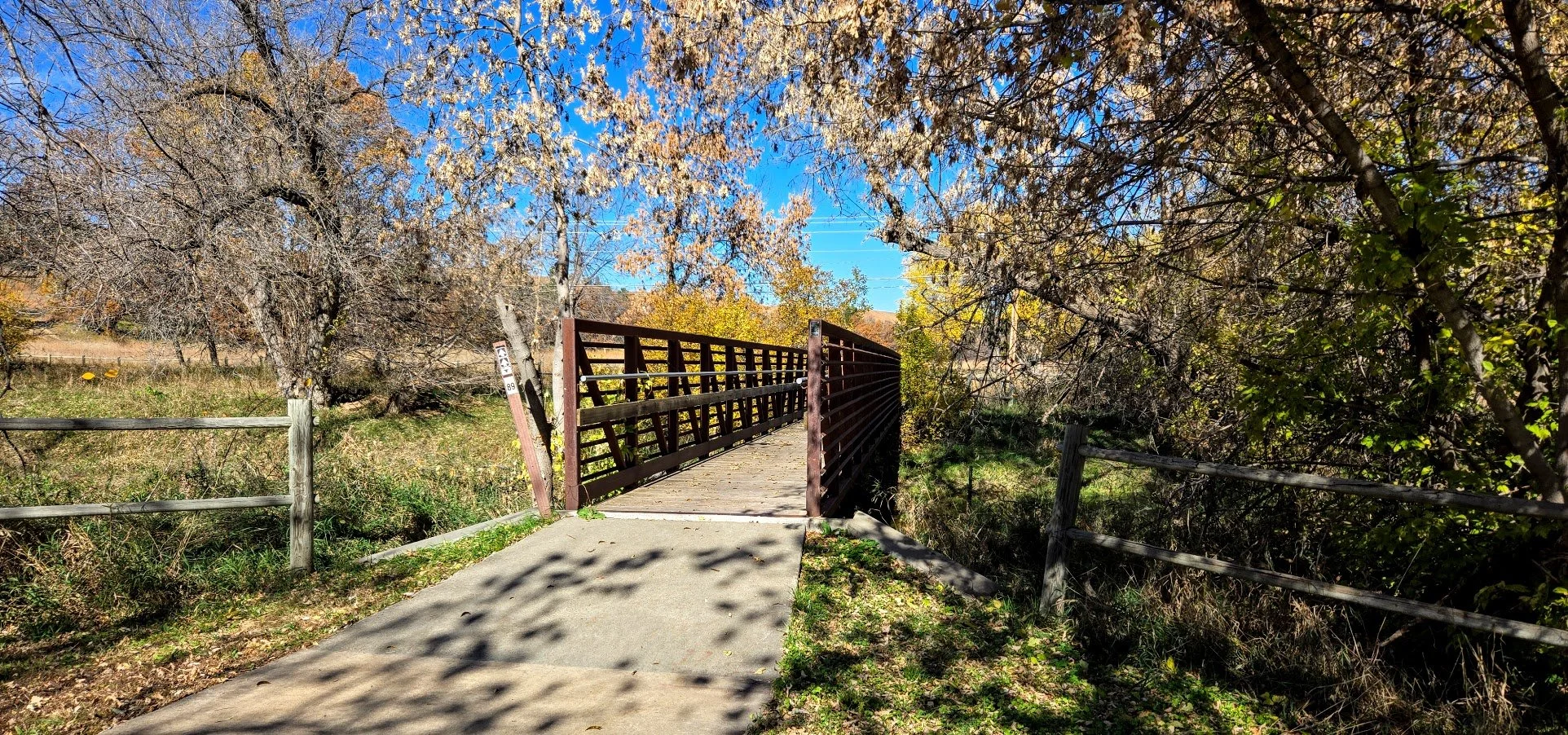
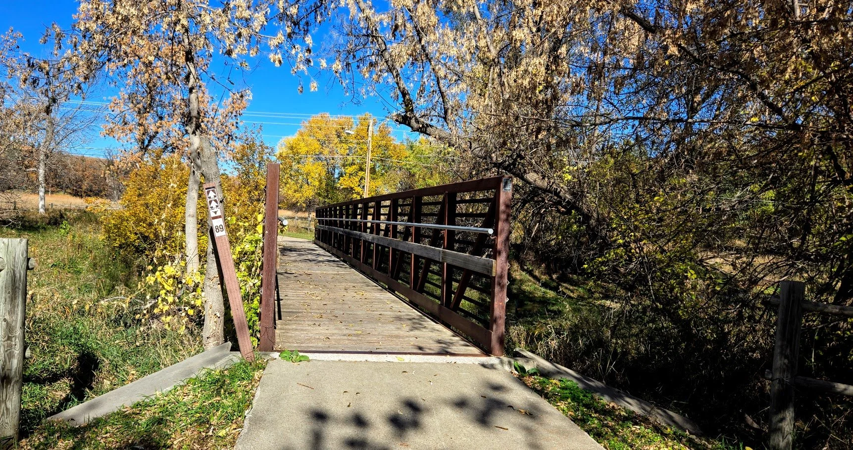
Bridge that crosses Bear Butte Creek.


Come out of the trees and heading into the prairie for the rest of the hike.

Approaching lots of cows.

Just one lone cow - Nope.

More cows, and some cows refused to even move and just stared you down.

Very hot.

More cows right on the trail.

Finally on the other side of the fence of the cows - Moooo away cows.

Not much to see here.


Signs tend to be knocked down by the cows.


On the road, turn to the south.
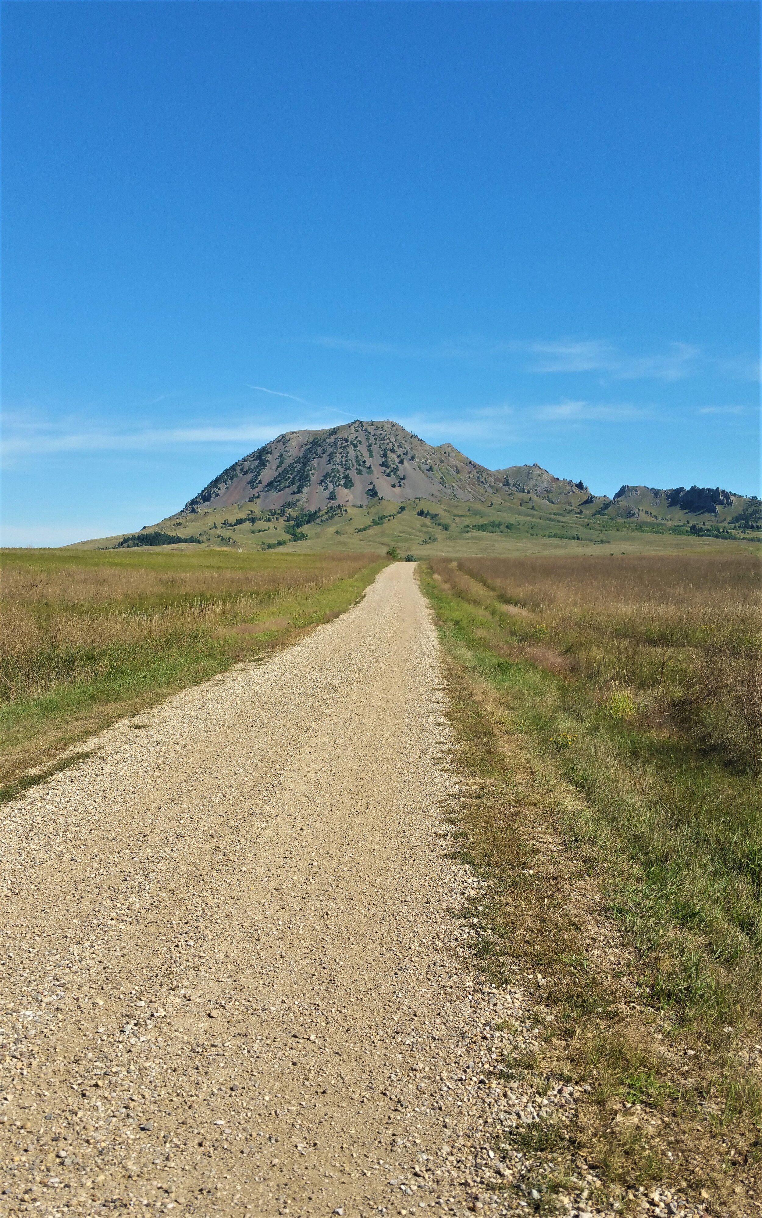
Seems like a long road to Bear Butte.


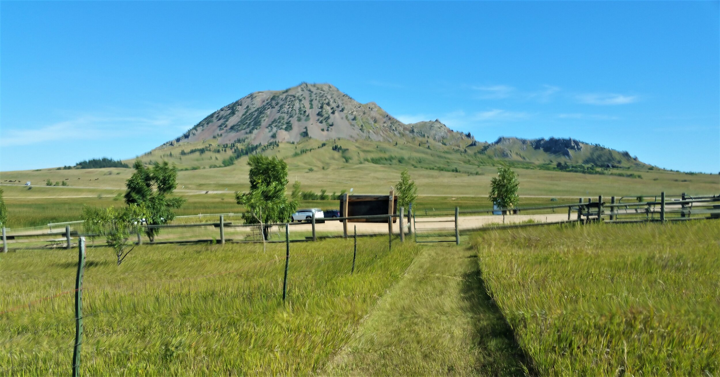
Entering Bear Butte State Park and leaving Fort Meade Recreational Area.

Can get close to the lake near the end.
Can see the end.

Nice picnic area and place to rest.


Made it.
Update - We checked the area in Sturgis in February of 2024 and they had rerouted the trail from the beginning of the Fort Meade Trailhead. The trail now crosses the street, goes across this bridge and onward. There is no need to go down in the gully anymore getting wet. This is a nice improvement.